
Mapping Ararat: An Imaginary Jewish Homelands Project is an effort to envision what the town of Ararat, a failed project by Major Mordecai Noah in September 1825 to found “a city of refuge for the Jews” in Grand Island, New York, could have looked like if had it succeeded in its goal. One of many unsuccessful efforts in modern history to carve out a nation for the Jewish people, Mapping Ararat offers the user/participant the tools to imagine an alternative historical outcome for Noah’s Ararat and to navigate through an imaginary Jewish homeland. Utilizing digital media technologies such as augmented reality (AR) and simulated cartography, this project gives Ararat a virtual chance to become the Jewish homeland that its founder had envisioned over one hundred and eighty years ago. The project consists of an on-site augmented reality walking tour of the contemporary landscape of Grand Island as well as an interactive cartographic landscape set up in a 3D virtual world within a gallery installation. It also includes a "Vernacular Culture" section of the website which includes information on imagined historical artifacts such as money, flags, postcards, and stamps - so-called "simulations of statehood" - that might have been created had Ararat been realized.
(Description adapted from information on project website)
Subject Period (epoch)
Subject Continent(s)
Subject Country(ies)
Topic(s)
Subject Language(s)
Project Type(s)
Project Language(s)
Project Media
Project Access
Project Status
Project Creator Continent(s)
Project Creator Country(ies)
Project Creator City(ies)
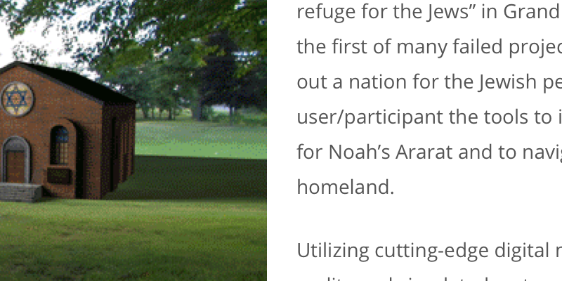
Mapping Ararat: An Imaginary Jewish Homelands Project is an effort to envision what the town of Ararat, a failed project by Major Mordecai Noah in September 1825 to found “a city of refuge for the Jews” in Grand Island, New York, could have looked like if had it succeeded in its goal. One of many unsuccessful efforts in modern history to carve out a nation for the Jewish people, Mapping Ararat offers the user/participant the tools to imagine an alternative historical outcome for Noah’s Ararat and to navigate through an imaginary Jewish homeland. Utilizing digital media technologies such as augmented reality (AR) and simulated cartography, this project gives Ararat a virtual chance to become the Jewish homeland that its founder had envisioned over one hundred and eighty years ago. The project consists of an on-site augmented reality walking tour of the contemporary landscape of Grand Island as well as an interactive cartographic landscape set up in a 3D virtual world within a gallery installation. It also includes a "Vernacular Culture" section of the website which includes information on imagined historical artifacts such as money, flags, postcards, and stamps - so-called "simulations of statehood" - that might have been created had Ararat been realized.
(Description adapted from information on project website)